Challenge Overview
A photograph was taken in Paris on December 3rd, 2023, around 18:00. The image shows a masked individual standing in what appears to be a central and upscale district of Paris.
The objective of this challenge is to identify the nearest Paris metro station to the location where the photograph was taken, using only OSINT and GEOINT techniques.
This challenge emphasizes:
- Urban structure analysis
- Environmental and architectural clues
- Visual text recognition
- Mapping and transportation infrastructure correlation
Flag format:
OSINT{STATION_NAME}
Rules:
- All uppercase
- No accents
- Use underscores between words
Initial Assumptions
Based on the challenge description and the provided image, the following assumptions were made:
- The photo was taken in Paris, specifically in a central and upscale area.
- The timestamp (around 18:00 in early December) suggests early evening lighting conditions.
- The scene is located near the intersection of a Rue and an Avenue, which is common in Parisian city layouts.
- The presence of well-maintained sidewalks, tall trees, and clean architecture suggests a higher-end district.
Investigation Process
The attached image (mask.jpeg) shows:
- A person with their face obscured by orange lines, wearing a mask
- A building facade behind the subject
- A visible advertising sign placed along the sidewalk
- A tall tree on the sidewalk
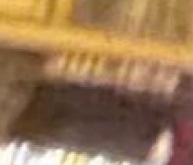
- Partial readable text on the building that appears to say “Julien”
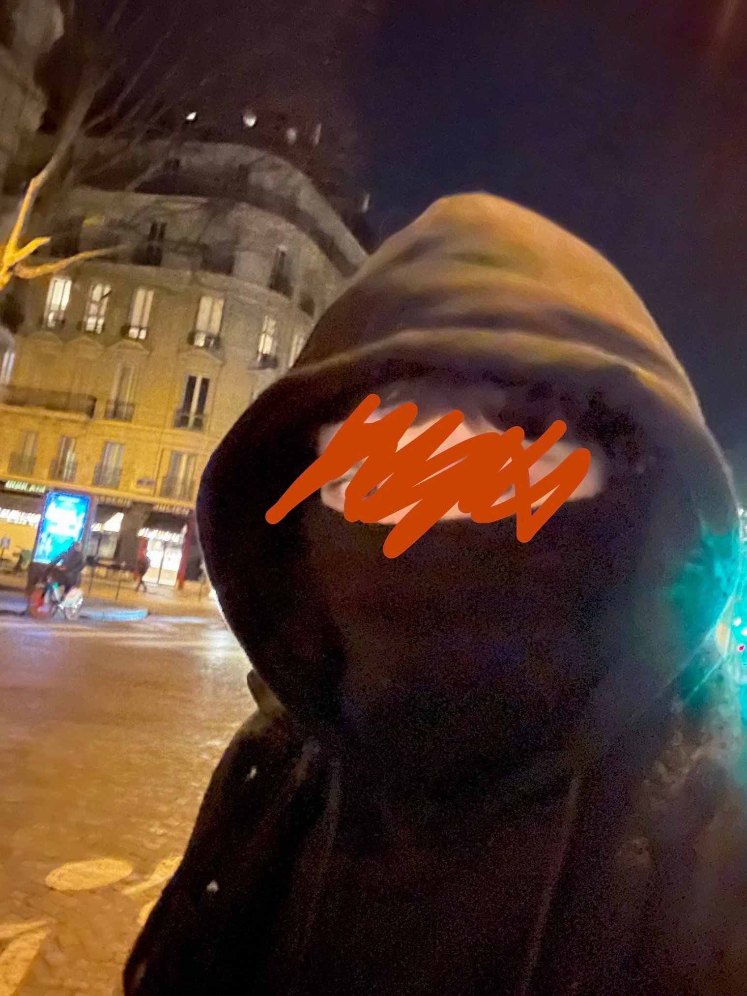
The word “Julien” stood out as a strong textual clue and became the primary pivot point for further investigation.
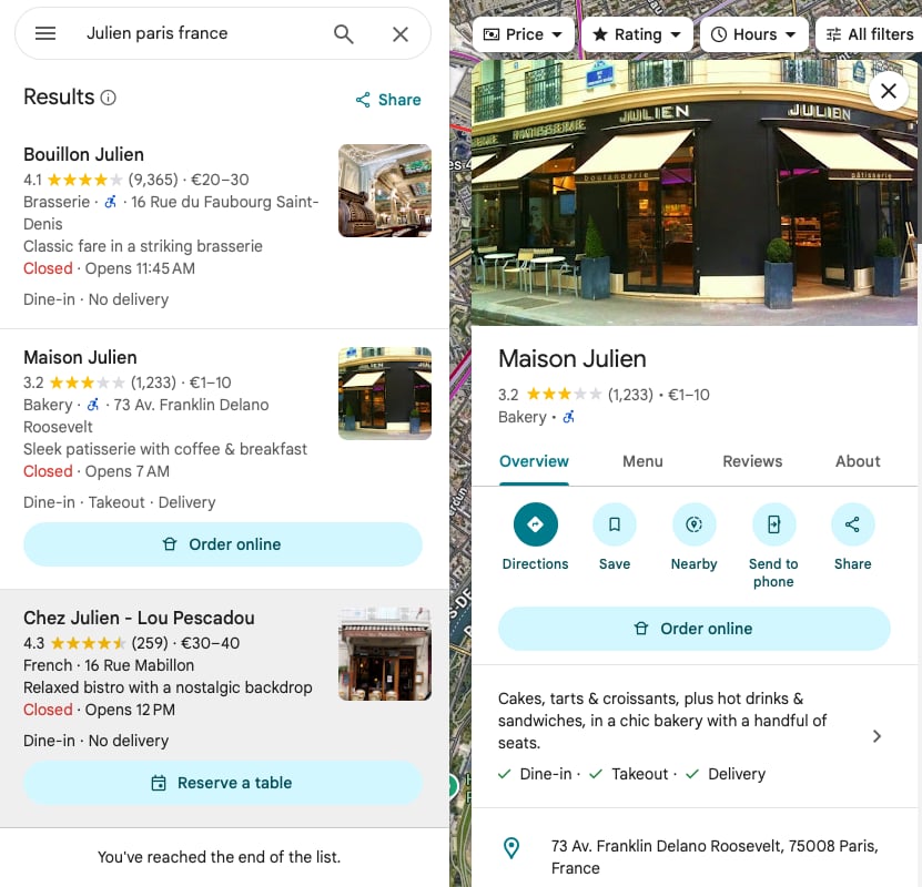
2. Text-Based OSINT Pivot
Using the visible text from the building, a search was conducted on Google Maps using the query:
Julien Paris France
This search returned several results, but one location immediately stood out:
- Maison Julien
3. Google Maps & Street View Correlation
Upon opening Maison Julien on Google Maps and switching to Street View, multiple visual elements matched the original photo:
- The same building structure and facade
- The “Julien” signage on the building
- The advertising sign on the sidewalk
- The position and height of the tree along the street
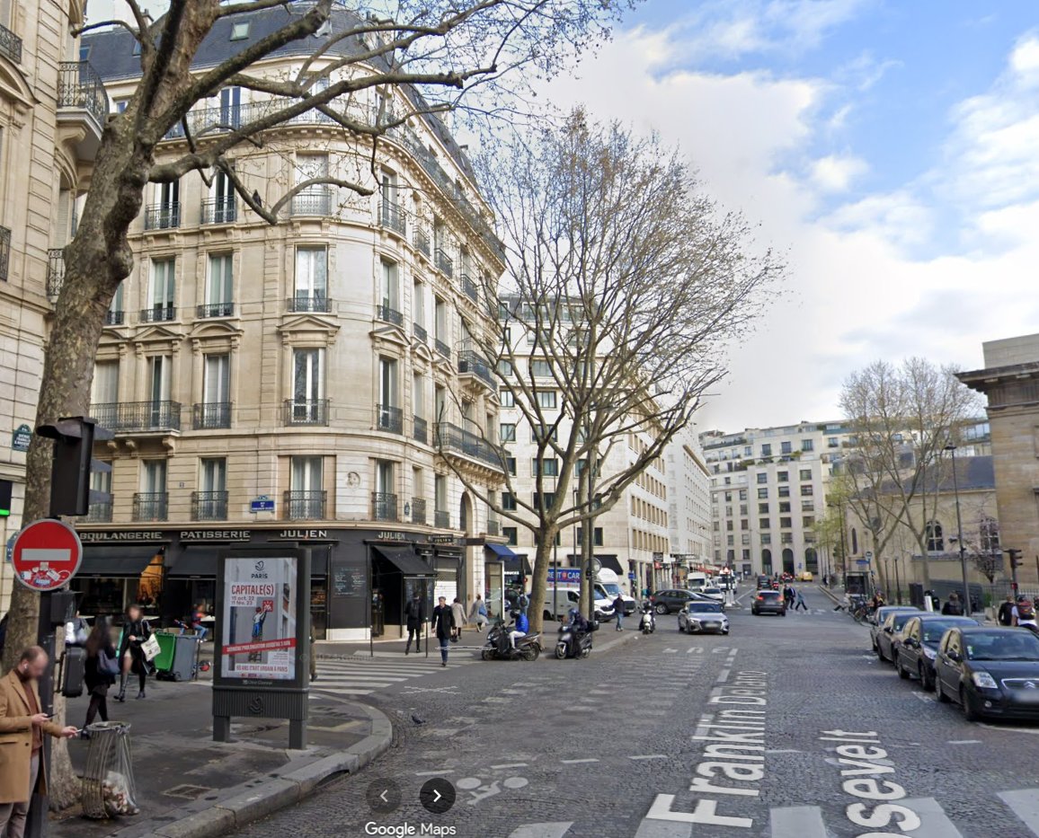
These matching environmental and architectural details strongly confirmed that the photo was taken near Maison Julien.
4. Identifying the Nearest Metro Station
With the location confirmed, the next step was to identify the closest Paris metro station.
Using Google Maps, nearby metro stations were reviewed based on walking distance.
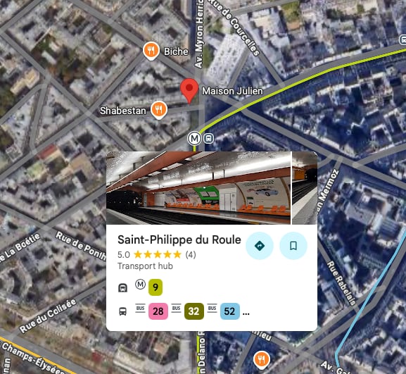
The nearest metro station to Maison Julien was identified as:
- Saint-Philippe-du-Roule
Key Findings
- The partial building text “Julien” was a critical OSINT clue
- Maison Julien matched all visual and environmental elements from the image
- Street View validation confirmed structural consistency
- The closest metro station to the confirmed location is Saint-Philippe-du-Roule
Final Flag / Answer
OSINT{SAINT_PHILIPPE_DU_ROULE}
Notes & Takeaways
- Even partial text in an image can be enough to pivot an entire investigation
- Combining visual analysis + map tools is extremely effective for GEOINT challenges
- Street furniture (signs, trees, sidewalk layouts) are powerful location identifiers
- Always validate assumptions using multiple matching details, not just one
This challenge is a great example of how small environmental clues can lead to accurate geolocation when analyzed methodically.